
About the Study
About Shooks Runs
The Envision Shooks Run study focuses on one of the more important stream corridors in the central part of the City of Colorado Springs. The study area encompasses two boundaries: the Community Planning and Transportation System Area boundary (noted in blue in the map above) and the Infrastructure Planning Boundary (noted in red in the map above). The project area is generally located to the east of Downtown Colorado Springs, between the Patty Jewett Golf Course area and the Fountain Creek corridor, to the south. It encompasses the southeastern quadrant of the Legacy Loop trail.
Envision Shooks Run is a multi-modal transportation and drainage infrastructure study initiated by the City of Colorado Springs to address challenges and opportunities along the Shooks Run Corridor. The study is a collaborative, 16-month citizen-involved process that will result in a prioritized plan for future construction of much needed improvements to the aging infrastructure. But, rather than just addressing the challenges, Envision Shooks Run is an opportunity for an optimal plan that maximizes community benefits for all who use the corridor.
The City of Colorado Springs has initiated the Envision Shooks Run Corridor Study recognizing its responsibility:
- to manage and improve the infrastructure in our City
- for planning, budgeting and performing maintenance and capital improvements
- to identify funding to address issues
- to listen to our community for guidance on how best to accomplish these things
- to make the final decisions while considering technical analysis and public input
A Letter from the City Project Manager
For more than a hundred years the Shooks Run Corridor has served a functional purpose, but it has also been a “diamond in the rough” with tremendous potential. Now referred to as the “Legacy Loop,” it was envisioned by city founders as integral to a “park ring” around the city core: a creek and trail greenbelt for all citizens and visitors alike to use and enjoy for recreation, transportation, and tranquility.
Although recognized as a community asset, infrastructure along Shooks Run is deteriorating from lack of maintenance over the years. Overgrowth of invasive vegetation is harming the ecosystem. Bridges, retaining walls and culverts along the corridor are nearly a century old and in some instances deficient. As a stormwater drainage system, Shooks Run has aging and undersized drainage structures, increasing the risk for potential flooding. These issues must be addressed to protect citizen safety, property and property values.
Prior studies show the community vision for Shooks Run is to not only maintain it, but to improve and enhance it for better public health and safety, neighborhood access, transportation connections, property protection and enhancement, recreation and economic development opportunities.
The goal of Envision Shooks Run is to collaboratively work with the community to develop a prioritized implementation plan. Having such a plan in place will allow the City to pursue grant opportunities and other funding sources for the projects.
There are many challenges associated with Shooks Run, and they are all intertwined. Transportation connections, drainage, bridges, parks, trails, creeks and urban planning all need to be addressed together. We encourage you to join us as we seek to address the infrastructure needs along the corridor and implement the vision for parks, trails, streets, neighborhood aesthetics, and the creek. Your first-hand knowledge of the corridor and your ideas are very important to us as we work collaboratively to fulfill the vision for this community amenity.
Aaron Egbert, City of Colorado Springs, City Engineering
Envision Shooks Run City Project Manager
Corridor History
Shooks Run is a drainage basin and stream corridor east of downtown Colorado Springs. The Shooks Run Corridor from Rock Island Trail/Van Buren Ditch on the north to Fountain Creek on the south includes adjacent neighborhoods, adjacent park amenities, pedestrian and bicycle trails, and several roadways crossing the stream. This part of Shooks Run makes up the south eastern part of the Legacy Loop green space plan that rings the downtown area and was part of General Palmer’s vision for the community.
A majority of the infrastructure in the area was constructed from the early 1900’s through the 1960’s. The grid system of streets in the area results in numerous roadways of various functional classifications crossing Shooks Run. Much of the infrastructure and many of the bridges are reaching the end of their service life. To be fiscally responsible, the City of Colorado Springs desires to develop a sustainable infrastructure replacement strategy for the Shooks Run Corridor infrastructure including:
- Bridges and roads
- Stormwater (including retaining walls, culverts)
- Traffic and multimodal transportation
- Parks & Recreation (implement the vision for parks, trails, streets and the creek)
- Urban Planning (implement the vision for neighborhood aesthetics, for example streetscape and historic features)
“The creek was named after Peter and Denton Shook, two pioneers who settled here in 1865 and ran cattle in what was then a broad prairie basin.“
– Dave Philipps, The Gazette, October 15, 2006
Shooks Run, the creek in history and neighborhood
(View a historical perspective of Shooks Run, Middle Shooks Run Neighborhood Association)
Project Purpose and Need
Envision Shooks Run is a City of Colorado Springs initiated multi-modal transportation and drainage infrastructure study. It is a citizen-involved, collaborative decision-making process to identify existing problems and opportunities along the Shooks Run Corridor specifically regarding:
- Condition – deteriorated roadways, bridges, retaining walls and culverts
- Capacity – undersized drainage structures resulting in flooding
- Safety – safety concerns for flooding
- Maintenance – limited access, limited funding leading to lack of maintenance
- Use – implement the community vision for parks, trails, streets, neighborhood aesthetics and the creek
Envision Shooks Run involves development and study of alternatives such as: traffic calming, street closures, pedestrian and trail connections, alternative hydrology solutions, funding sources, and others ideas to best balance the needs of this area with a sustainable infrastructure replacement plan. Evaluation of alternatives will include considerations such as: citizen input, aesthetic elements neighborhood circulation and connectivity needs, stream corridor plans, park and open space development plans, and multimodal transportation, transit and traffic circulation needs.
Building upon the historic vision for Shooks Run, the study will lead to a prioritized plan for future construction of much needed improvements to the aging infrastructure. In addition, enhancement opportunities that maximize community benefits for all who use the corridor will be evaluated as part of the study effort.
Envision Shooks Run is funded by the City of Colorado Springs and the Pikes Peak Rural Transportation Authority.
Corridor Issues
The two major issues that have caused the City to take action and begin this project are the current conditions of the Bridges and the Channel along and crossing the Shooks Run stream channel. In recent efforts by the City to develop a plan to address these two issues, it was recognized that the intertwined nature of these two issues as well as maintenance, stormwater, trails, parks and others requires that a plan for all must be developed to appropriately address the bridge and channel issues.
Bridges
Three of the nineteen roadway bridges over Shooks Run are over 100 years old. In addition, there are another six bridges that are over 50 years old. Guidance is needed for the corridor prior to beginning to replace and/or rehabilitate the bridges over Shooks Run. View photos >>
Channel and Stormwater
The current FEMA Floodplain along Shooks Run shows the potential for significant flooding should a large storm occur. Addressing this risk of damage to both private and publicly owned property is necessary. View map >>
Study Process
Envision Shooks Run Study Goals
- Develop implementable improvements. The design will consider opportunities for enhancements that may include associated improvements to park and open space areas along the corridor and may also enhance potential corridor redevelopment.
- Identify how potential improvements along the corridor may be phased over time.
- Identify potential funding sources for improvements, and how the planned improvements along the corridor would integrate into the City’s Capital Improvements Program (the City’s roadmap for public improvements in the future).
Bridge & Road Planning
Roads and bridges provide ways to travel between places in our community. As a result, the configurations of both respond to the goals and values of our community. For many years Shooks Run has been a constrained corridor and therefore has a well established pattern. Planning for and implementing improvements to the bridges and roads requires information from the community so that the response is appropriate. To define what is appropriate the City wants to establish if the community wants to change Shooks Run and if so how.
Bridge and roadway evaluation, conceptual design and other support for technical evaluation will be developed as part of the study. This will be done in support of the traffic and transportation planning, drainage basin planning, parks and recreation planning and community development efforts that will be conducted as part of this project.
Traffic and Transportation Planning
With the City’s commitment to accommodate all models of travel, the Shooks Run project presents a unique transportation planning opportunity. As Shooks Run Corridor infrastructure is rehabilitated and replaced, opportunities will be created to enhance the multimodal mobility along the corridor and for facilities that cross the corridor. The purpose of the Traffic and Transportation Planning task is to understand the transportation planning context of the corridor and to identify opportunities to enhance the City’s multimodal transportation network in and around the study corridor.
Drainage Basin Planning
This portion of Envision Shooks Run focuses on the need to update the hydrologic and hydraulic analysis (how much water and how water flows in Shooks Run) for the basin, in anticipation of planning for long-term improvements along and near the Shooks Run Creek corridor. The hydrologic and hydraulic analysis will aid in identifying issues related to flooding, erosion, and undersized infrastructure within the Shooks Run watershed. Once problems have been identified through collaborative community involvement and technical analysis, alternative solutions and a conceptual plan will be developed for the various Reaches of the Shooks Run Corridor.
This task focuses on the furthering the evaluation of existing stormwater facilities and identification of opportunities along six reaches in the Shooks Run Drainage Basin and provide the City with Action Items to move forward into implementation along those six reaches. They include Evaluation and Planning for the Reach of:
- Reach #1: Shooks Run from the Confluence with Fountain Creek to Costilla Street (Primarily flows through the South Shooks Run Park)
- Reach #2: Costilla Street to Kiowa Street (Primarily Industrial/Commercial Development along Shooks Run)
- Reach #3: Kiowa Street to Boulder Street (Shooks Run is piped for a majority of this Reach)
- Reach #4: Boulder Street to Cache La Poudre Street (Flows through the Middle and North Shooks Run Parks)
- Reach #5: Cache La Poudre Street to the Southern Patty Jewett Golf Course Boundary (Shooks Run primarily flows through private property along this reach)
- Reach #6: The Southern Patty Jewett Golf Course Boundary to the Van Buren Channel. This reach includes the main stem of Shooks Run that Connects to the Van Buren Channel at Templeton Gap road and Constitution Avenue as well as the eastern tributary from the confluence with Shooks Run near the Patty Jewett Golf Course club house to the eastern boundary of the Patty Jewett Golf Course.
Parks and Recreation Planning
Parks and recreation facility opportunities are a vital component of the community's transportation system and waterways. The Legacy Loop, identified and set as a high priority in the 2014 Park System Master Plan, links the Shooks Run Trail and the Pikes Peak Greenway Trail to ring downtown Colorado Springs and connect recreation opportunities, parks and green spaces that embrace the waterways and enhance the neighborhoods and business/commercial areas. A goal of Envision Shooks Run is to produce a sustainable development strategy for corridor parks, recreation and trails that is integrated with all future corridor infrastructure. Parks and recreation are a unifying component of the Shooks Run Sustainable Infrastructure.
Community Development
Economic analyses and a careful examination of economic development opportunities will support the development of Corridor Vision Themes and Conceptual Alternatives. Markets for residential, commercial, and office in the areas surrounding Shooks Run will be analyzed for redevelopment in the various segments of the corridor, over time. This information will provide a more realistic framework and background to help plan for the nature and phasing of improvements over time.
Stages of the Study Process
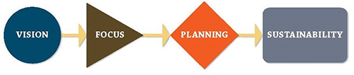
Envision Shooks Run involves four major steps:
Vision: this step builds from previously established community visioning and planning processes
Focus: refines the multiple visions to clarify a true Shooks Run Corridor vision
Planning: determines how to best compliment the corridor vision with specific alternatives
Sustainability: develops an implementation plan of action and identifies potential funding sources
Integrated in the steps above will be a process that involves:
- Community Input/Visioning
- Alternatives Development
- Screening Criteria – screening criteria will be developed and used to evaluate each of the potential alternatives. Potential screening criteria could be:
- Safety
- Flood Plain
- Street Network Mobility
- Active Transportation
- Maintenance
- Environmental Impacts
- Private Property Impacts
- Economic Vitality
- Construction Impacts
- Implementation
- Aesthetic Value
- Community Development Potential
- Park and recreational value
- Technical Analysis and Evaluation
- Preferred Conceptual Alternative Development
- Corridor Study Report, Facilities Master Plan, and Sustainable Infrastructure Plan
Facilities MASTER Plan
Review Facilities Master Plan Here
Review Facilities Master Plan Executive Summary here
Join the Discussion
Sign-up for our e-newsletter to receive meeting notices and the latest project information.
Send us an email to share your comments and feedback, we appreciate your input!
Photo Gallery
View images of various locations throughout the study area.
Community Values Driving the Project
Public Input - Community Values
Quotable
“The beauty of Envision Shooks Run is that it’s a holistic planning process that considers public safety, stormwater and drainage, infrastructure, parks, trails and creeks. These are all critical projects that are important to the city and to its citizens. Ultimately, this project is about how to best serve our city and the community by making more of the natural environment and more greenway corridors accessible for the benefit of the community.”
Andrea Barker, Greenway Fund Legacy Loop Project